Stay up to date
NFAA News
NFAA News
Sep 12, 2018
Special Series: Effective Gear for the Backcountry Bowhunter. Part 5: Navigation and Safety.
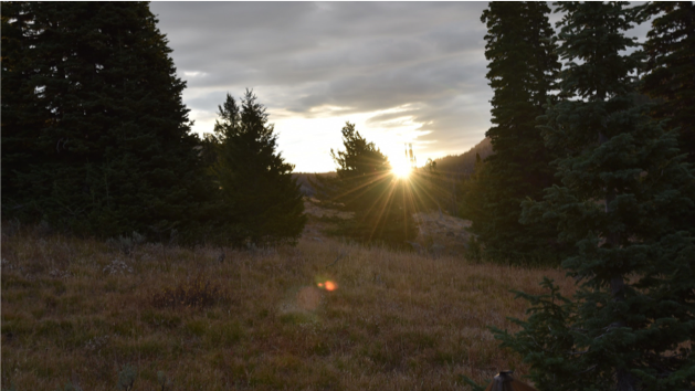
Navigation in the backcountry, especially for those reading this that have never been in the backcountry, is essential to not only your success but your safety. As time progresses, so does technology and the ease of using electronics in the backcountry to navigate. But be forewarned: if you rely solely on electronics as your only way of knowing where you are, how to navigate hunting plans, and your way in and out of the backcountry, you could end up wishing you took the time to learn how to use paper maps. In my opinion, and the opinion of many others, your skills as a backcountry hunter simply aren't whole, until you understand how to use a compass and a map.
I'll get off that soap box for a bit, but if you haven't nailed it yet, I'm trying to send you a clear warning. Your electronics most likely are going to fail you eventually if you spend enough time in the mountains. That sounds crazy when we live in a world where we just have to ask our phones where the closest gas station is and you instantly get turn-by-turn directions. However, land navigation is one of the basic skills of the hunter that everyone should know. I cannot stress enough how important it is for you make physical maps of potential hunting areas, know how to read coordinates on those maps, understand the features and topo lines on a paper map, and be able to relay your coordinates to others for a variety of potential reasons.
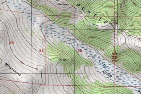
You can order online and even print maps in advance from places like the National Forest Service and the USGS (United States Geological Survey) and USDA (United States Department of Agriculture. Almost every state now, I believe, also has its own hunt planners. These online resources feature downloadable maps and KMZ files to download to Google Earth on your computer which will provide overlays for road and trail systems, unit boundaries, and more. Additionally, there are other sources like MyTopoUSA and Northwoods Mapping, just to name a couple, where you can also order paper maps in advance. You can usually find maps of just about any area by stopping at any of the National Forest Service offices in any state and purchasing maps by quadrants. Also at those offices you can pick up motor vehicle use maps that show which roads are ones that are open or closed seasonally and what types of travel are allowed on them. As a cautionary statement though, those open and closed season dates can change without notice except at the trial head. Wildfires can also impact road closures. For that, you can keep up to date on current fire issues and areas by clicking here, at the US Forest Services Active Fire Mapping website.
When making your maps, either laminate or seal the maps with packing tape and make additional maps of the areas around the area you THINK you'll be hunting. I almost always seem to wind up hunting close to where I expect, but not always that exact area. So the additional maps, even if you leave them at the trailhead after realizing that you need to expand your hunting areas, it may be worth the trip back to the truck to explore deeper than you thought you had too, to find game in some units. For me, I just carry them all with me.
The depth and detail to this topic is so huge that I'm going to pass on explaining it much further for this article. Not because I don't know it, but because it is a LOT to explain. I review maps almost nightly from my base camps. When it comes to using those maps and learning land navigation, I'm going to point you to a great resource that outlines the basics and provides a general understanding of how to use land navigation with maps. In this short article, I cannot adequately explain how to use a compass correctly, shoot waypoints, read and relay coordinates, and understand topographic features. You should seek out a book on the subject that has in depth chapters.
There are many online classes you can take on the subject. One of the best free crash courses I can point you to is a two part YouTube series by Gritty Bowmen and podcasts with Aron Snyder from Kifaru. I bring up Aron a lot in articles because he's one of few people that I know of that spends in excess of 200 plus days a year in the backcountry across the West and Canada that freely shares information on a regular basis. Here are the links to Land Navigation 101 and Land Navigation 102.
[embed]https://www.youtube.com/watch?v=MMme-JOEyMU[/embed]
-
[embed]https://www.youtube.com/watch?v=SyygfvCyXaM[/embed]
The amount of information you will receive in these two YouTube videos, I would have to say you'll be hard pressed to find another resource that lays it out so simply. That being said, there are a lot of different resources out there if you don't enjoy this type of format for learning. Again, if you don't already possess the skills necessary to navigate with a compass and paper map, take an online class at the minimum or find someone who knows how to use them accurately. There are advanced multi-day, in person classes, are available from private individuals. You can find online just about anything you really want to know or everything there is to know about the topic. I also strongly suggest, even though you may be carrying a PLB (Personal Locator Beacon) such as a SPOT or Satellite phone like the Garmin inReach, do your best to plan your hunt route in advance of your hunt. Hand a copy of those maps to your closest friends or loved ones so that they can at least direct rescue workers to your approximate area you'll be hunting and where you'll likely be parking, should something unthinkable happen during your hunt. That goes for solo hunters and hunting buddies alike.
Most of you will want to and should seek a form of GPS or electronic means of knowing your location and hunting areas. I carry 4 forms on me- as crazy as that sounds! On an Idaho backcountry hunt just three years ago, I packed in on a trail system to about 6 miles on a tip from a local. Being a weekend with the Forest Service office closed, I neglected my rule of always carrying paper maps. I did download the area map onto my Garmin handheld while in town. I found the trail head easily and from there, I followed the main forest service trail to where two creeks converged and rolled out to another parking area about 14 miles from there. Thinking it was impossible to get turned around with the creeks I located on my downloaded maps, I trekked off trail straight up a mountain, down another, and up another before locating a bull. I was approximately 10 miles from my truck at this point. On my person, I had my typical electronic navigation tools. A Suunto Traverse Alpha watch, a Garmin 401 Foretrex, and a Garmin Oregon 600. In addition to those three items, I had my phone, but I didn't have OnX maps for my phone back then. So I'm starting off this real world example with only 3 navigation tools instead of the now standard 4 forms if you count the OnX app on my phone, and although I knew nothing of OnX at that time, that alone could have shortened a very long night for me.
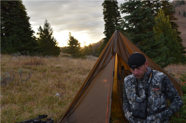
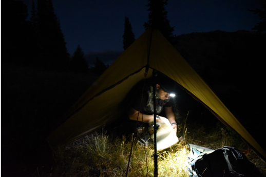
When I heard the first bull pipe off, it was almost dark. I setup my Supertarp, made preliminary plans for the morning, nestled in my Bivy, and listened to him scream his head off till almost about 3 am, and finally fell asleep. I was up at first light and ready to start my hunt when a bull bulged in a different direction that sounded very deep and mature. Way more mature than the bull I listened to all night. I decided that was the bull I would head after. As usual, my plan was to quietly pursue that bull until he bedded and attempt a stalk at some point throughout the day. In my head, it was impossible for me to get turned around because I would use those creeks as a bumper, or handrail as they call it in the land navigation world, if for whatever reason my electronics failed me. Again, this an area where I got a tip from a local, so I had no maps for it that I was able to make before I started my trip from Iowa. And, my impatience to wait for the forest service office to open to get a basic map got the best of me...mistake #1. I should have simply explored another area that I did have paper maps for in advance, and then went to the Forest Service office after the weekend to purchase the needed map(s). But?I didn't.
It seemed easy to locate the area and drainages the local hunter pointed me to on Google Earth. Looking at it from my laptop at the local library, I couldn't imagine getting turned around in any part of that country. Plus, I took a picture of the area with my phone as a screenshot, so that should be sufficient. As a backup to that, I downloaded that map into my handheld from the Garmin BaseCamp Software. So why waste time letting a hot tip go cold, instead of hitting another spot that I thought there might be elk in, when this guy seemed positive there were elk where he had pointed me? The gentlemen had already killed his bull and explained to me he usually hunts much different areas in the state because wolves had become a problem in the area lately. The gentleman seemed sincere and wasn't much of a trophy hunter and I just had a good feeling about his advice.
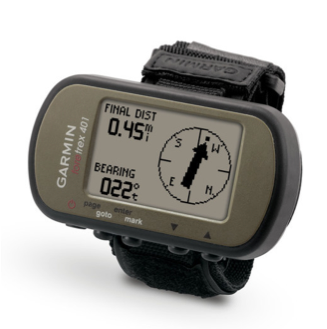
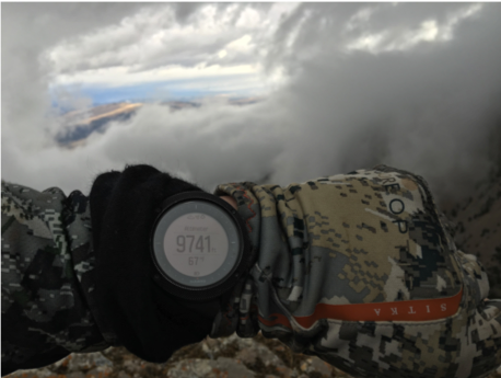
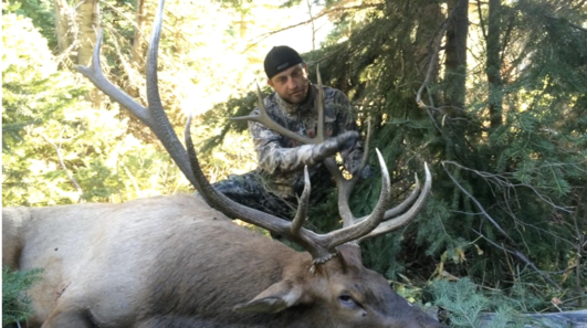
Before leaving my basecamp, I marked it with my Suunto, my Garmin Foretrex (shown in the image above), and my Oregon 600 handheld. When a bull bugles, especially a gnarly deep, raspy growl...I tend to immediately go into kill mode. Most of you that turkey hunt know that same feeling...it happens to most of us when a gobbler sounds off...total adrenaline rush! Not shockingly to those of you that know me, everything in my mind shuts down except what I need to do to get into bow range. The decision to leave most everything except my kill kit, water, and medkit was a dumb one. That's something I never do and in this instance from what I could see on my handheld, there was an almost zero chance I would have to chase this bull too far because he would run out of options to bed in because of lack of suitable habitat ahead. In short, I didn't think I would be gone long or far from the camp. In the heat of the moment, as I was putting on my pack, my Suunto watch had apparently caught on my pack strap, the band attachment popped off, and my watch was left at camp unknowingly.

Mistake #2...I was only a couple hundred yards from camp when I realized I was missing my watch (I run the Suunto Traverse Alpha shown above). "Who knows if it's at camp or somewhere on the ground in the past couple hundred yards, but I'll just find it on the way back", I thought to myself. Heck, I still had two other forms with me, that's what backups are for, right? I soon spotted the bull. He had just a handful of cows with him and traversed a trail across a large rock slide, back down a dark timber pocket on the other side of the mountain, crossed a creek, then went back up to the top of that mountain and over the other side. He followed that back side of the ridge for several hundred yards or more and then down another drainage and across another faint trail on a large rock slide, before finally hitting a steep north facing timber pocket. Hard to picture? Yep, it's hard to just regurgitate all of that in a readable format, but I can promise you it's burned in my mind! Now imagine relying on and assuming your electronics has been tracking your trail the entire time while your focusing entirely on keeping up with elk as they continued to push through all of those areas. It's extremely difficult to keep up with elk on the move, even as they were slowly moving. I on the other hand as a human, was sucking air and burning muscles trying to keep up with their leisurely stroll, but I pulled it off and now I was in a great glassing position.
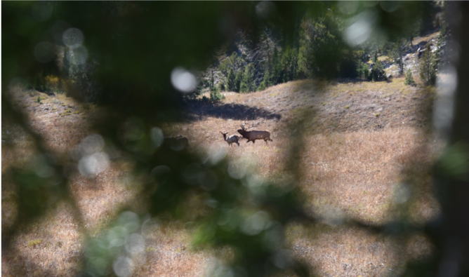
I watched patiently for over 2 hours to assure that the elk were finally bedded for the afternoon. Generally, this is how I kill almost all of my elk rather than calling. I've just found that in highly pressured OTC units like this one, no calling is the best policy, unless you're just trying to locate elk somewhere in new areas. It was now almost 2pm and I was exhausted from trying to keep up. I formulated my plan from just inside the timber canopy I was glassing from and reasoned that if I could stay in the cover and make it to the top and over the ridge, I could potentially parallel the ridge on the backside, and pop over where the dark timber came closest to top. I would only have to make it 100 yards or so from the top of the ridge to get down the rocks and into the timber. Seemed doable. These were big rocks, and as long as I watch my step, I can usually navigate quieter across rocks than moving though the timber as long as I could avoid getting spotted. I had ranged from where I was glassing from, to the timber pocket I was headed too. I also used my inclinometer on my small leupold rangefinder to estimate the elevation the elk most likely were bedded in relation to my glassing point. That's how I calculated about what my distance was from the ridge top to the top of the timber pocket and the distance it was from there to where the elk entered the timber. Assuming they remained at that elevation, my Suunto watch would show me roughly how far I could expect to drop into the timber before getting close to the elk. In addition, referencing my Garmin handheld for what the contours looked like in that timber pocket, I found a steep cut in terrain which more than likely indicated a wallow or seep of some sort. In my experience, after a long trek like that, elk bed in heavy cover where there's at least some sort of source to drink from. Especially on sunny days like this one.
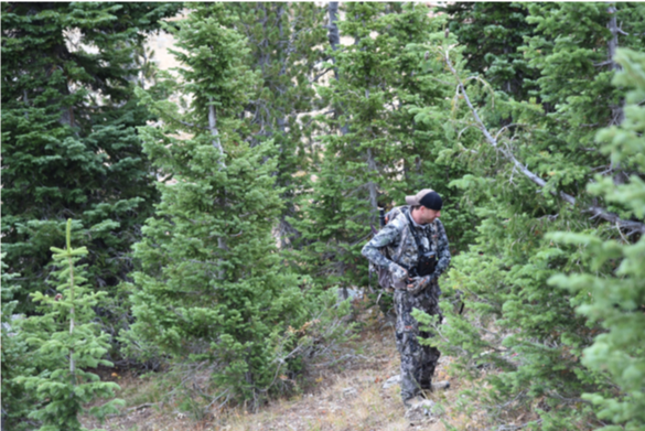
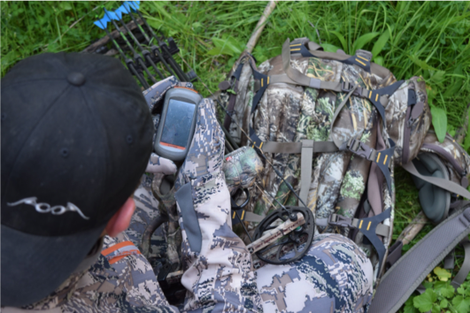
Up and over the ridge I went and began to travel the length of the ridge, hoping to not bump any muleys that could ruin the stalk. When I thought I was nearing the point where I would need to pop back over to the side the elk were on and drop in, I reached for my handheld. Any of you that have used one of these, knows that there is a carabiner that is attached to a strap that ties into a plastic slide that holds the unit "securely" to keep it handy. For me, I keep that carabiner attached to my left strap on my pack. Well, you guessed it...that plastic piece isn't exactly, "secure". *%#*! All that was attached to my pack, was a carabiner with the strap. And yep, just that silly piece of plastic, but no GPS. "Well, at least I know right where it is, I'll get it on the way back?way to go hero", I thought to myself. Mistake #3- ALWAYS when getting up from glassing or stopping for any reason, look around where you get up before moving on!
I slowly popped my head above the ridge and ranged the distance back to where that GPS most likely laid, at my last glassing point where I laid all my well thought out plans...650 yards. I peeked over the ridge and slipped down the steep rocks until I could see the treetops of timber I believed the elk to still be bedded in. The wind/thermals were good, the rocks all looked large enough that I could traverse them quietly, and I carefully glassed as well as I could into the dark timber. From what I could see, there were no elk or deer in the timber that could blow my descent into stalking range. So far, so good. I hit the timberline easily with no noise, stable winds, and in theory, above the bedded elk. 200 ft of elevation change is what my Suunto watch was telling me. That isn't all that far in this steep of country and from what I could remember there was a decent bench I assumed the majority of those elk were most likely laying on at that elevation. If they hadn't moved off while I was moving from my glassing point to here. It was almost 5pm at this point and I rested just inside the timber, glassing further down the slope planning a descent into what should be bow range. To keep this all in perspective, I had probably traveled about 3 to 4 miles from my camp, taking most of the day to make it that kind of distance with glassing, planning, and waiting repeatedly.
Typically, I will wait till I hear the bull bugle again before making my final move. I can't tell you this is the case all the time, but nearly all the time, in my experience, when a bull has gone silent midday, it's a sign that him and or the elk he is with, are indeed bedded comfortably. It's not uncommon to hear an occasional midday bugle, but once those bugles become more frequent and aggressive, it's a sign that either he's up and checking on cows, or the cows have gotten up from their midday rest and are slowly starting to move again. It wasn't long before a couple hundred yards below me, some cow talk began, followed by a that familiar growl I'd been following all morning. The winds began to shift a bit in the dark timber and it was time for me to skirt inside the timber using the heavy trails to slide into the same elevation. If I make it to that point in this scenario it is almost always a done deal. With only about an hour or so left of light, I proceeded with my planned approach. I didn't make it 100 yards when a black bear got up from his bed less than 60 yards from me, looking in my direction. "PLEASE, just go back about your business and let me pass", I thought as I stood motionless. I wish I could end this little hunt differently, but nope, the bear busted down through the timber and the deflating sound of hooves headed down the mountain at a high rate of speed echoed throughout the drainage. Ugh! Game Over.
Not every stalk by any means ends up in a good ending, in fact it's a very low percentage. But that percentage of success gets higher every time you fail. Never stop learning from failures! In this case my failure isn't the stalk, that was just plain bad luck. My failure was in the navigational portion of this hunt. I wouldn't change a thing about how I approached that stalk. Had that bear not been there, I'm very confident I would be including a picture of that bull in this story. But, this story hasn't ended...back to navigation.
With only about 20 minutes of light left, I wanted to get back across the rock slide to where I glassed last, pick up my garmin GPS, and head back to camp. With over 600 yards to go across a rockslide, you would think that distance would be easily covered by dark. Well, my closest calls to date for serious accidents in the backcountry involve rockslides. Sometimes, even though bigger rocks generally indicate more stable rocks, they aren't always stable. You absolutely need to exercise extreme care navigating them. I should have went on down the timber and got on the faint trail the elk used to get across the slide, but being in a hurry, I opted to angle back to my glassing position across the rocks. By the time I safely got back to where I thought my GPS was laying, it was indeed dark. No problem, I've got my main and backup headlamp, and nothing but time to find the handheld GPS. And, I marked this spot with my Foretrex 401 wrist strap before I got up so it should be easy to find, even in the dark. The Foretrex has an easy to see battery level indicator in the top left corner, I usually replace those batteries when it approaches the halfway level and almost every time before I head back into the mountains.
Well, for whatever reason, I didn't do that this time...Mistake #4. I had half battery life left when I left camp that morning and generally that will still last me several days. I went to hit the display/power button- nothing. "Are your freaking kidding me?!", I thought. I reached in my pack for my extra batteries, which at the time were not the same as my headlamp batteries, and those are at the base camp too!
The point of this entire story, is that even with THREE GPS units, in a 10 hour period, I successfully lost two and ran out of batteries for another. In this case, I let my determination to bring down a bull make several mistakes that led me to not being able to rely on my electronics. And, my biggest mistake of all, was not making paper maps. I did have my compass, one of two that I always carry with me. After almost an hour of searching for the GPS, temperatures dropping rapidly, I decided it's time to bail on looking for the handheld. It was that, or build a fire and freeze throughout the night until sunup.
I traced my tracks for the most part where I could, losing them multiple times, until I hit a rockslide I traversed earlier. I knew I had about 4 hours of life on my backup lamp based on how much I had used the light the night before and how much I've used it that night already. I navigated the rocks by moonlight and reengaged my headlamp when I hit the dark timber again. At some point I succumbed to the fact that my odds of getting turned around were increasing drastically, without much aid from my lights to constantly confirm I was on the right game trails. My cell battery was dead, and worthless at the time without OnXmaps installed anyways. At this point it was going to be a long night without my sleeping bag or much for spare clothes. I did have my emergency blanket, but honestly it's more comfortable to keep walking than using those things!
I pulled out my compass and decide to ditch the thought of finding camp all together and travel in the direction I knew I would eventually hit the stream that paralleled the main trail. That would leave me 6 miles from the truck, but who knows how far I was from it at this point! That was the best plan I could come up with though, and it was unrealistic to build a fire and freeze all night long. It's not like I would not survive by any means, but the level of discomfort in this situation is pretty high. In my head, I might as well walk all the way back to the truck after I find the creek with the main trail. Hiking all night is a better alternative to me than waiting out the night in the sub-freezing temperatures.
Very long story shortened, I eventually found the main trail, made it back to my truck, only to realize my keys were back at camp. I reached under the bumper where I kept my spare set with a magnetic holder...no magnetic holder. It had apparently fallen off somewhere between Iowa and Idaho. I walked the main road headed back to town, 16 miles away...I should make it there, by I don't know, like noon the next day. What a train wreck. The only good luck I had on that hunt, was that I ran into a guy at around 3 am on the forest service road just about a quarter mile from the trail head. He was just getting back with his horses from packing out the last load of a bull moose for his friend who had shot one earlier that day. He kindly gave me an extra sleeping bag he had in the horse trailer and some leftover hamburger he had previously cooked that day. I was able to stay warm and got just about an hour's worth of sleep before the sun came up. It was a LONG hike back to camp that morning but I found my camp easily in the daylight.
Do yourself a favor and invest in, at a minimum, the Garmin Foretrex. You should be able to find these new for about $150, used for maybe $50 if you look hard enough online. I have the 401 model, but I believe there is a 601 model that has advanced features, but that 401 is a life saver. Choose a headlamp that uses the same batteries. At the time I had several types of batteries for each device, that's changed now. A hunter is very wise to try to search for any electronic gear that all uses the same type of batteries, if possible. Had I been able to use my headlamp batteries for my Foretrex, I could have easily popped those in, used my backup headlamp when needed, got a great night's sleep at my base camp, and possibly woke up to chase that other bull near camp if he stayed in the area at all.
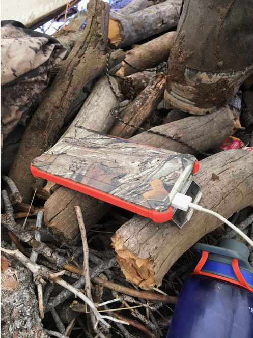
A note on electronics: most electronics that you may need, including steripens, cell phones and GPS systems, have rechargeable ports now. Although you usually have to choose between rechargeable ports, or disposable batteries, you can always run with Dark Energy chargers. About $100 each, I can keep my cell charged and run my phone for mapping, Instagram stories, and Facebook videos each day if I keep it in airplane mode. I generally will try to get a signal if I can once a day, and when I do, I publish my social media updates and check in with friends on my current situation.
Most of you won't likely document your hunts as much as I do of course, but out of each full charge on a dark energy, I can generally get 4 days' worth of charges on my cell. So I carry two of them hockey taped together at all times and one separate backup. As I upgrade in backcountry equipment, I am constantly looking for those charging options that are compatible with those Dark Energy chargers. They use a mini USB and regular port to displace charge as well as an Android type port to charge. Eventually I imagine, I will be running all of my electronics with those Dark Energy chargers. So far, for the budget constraints I'm on, I have yet to find another way to charge gear affordably for all the more amount of weight that they add to my pack.
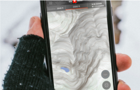
As far as navigation for your cell phone, I have experimented with a lot and nothing is more valuable as purchasing the OnX map app. You can upload maps anytime you have a signal, get detailed overlays for your maps about historical fire burns, trail systems, private and public land boundaries, and so much more, it's ridiculously awesome!! In addition, you don't even need a cell signal to run your mapping software and determine your location. We all know phones can be awful fickle though, so please don't plan on relying on that to replace your navigation systems. A simple set of paper maps and a good old fashioned compass would have also saved me that night from countless hours of misery and potentially the loss of another trophy bull.
Photo Credits: Rod White, Michael Lloyd of 41 Digital (who captures so many of my personal images used in several articles and social media), Garmin (401 Foretrex Pic), and OnXmaps (screenshot)
-
About the author: Rod White is an Olympic Archery Gold Medalist who has guided and outfitted in 5 states including Montana, New Mexico, Iowa, Illinois, and Minnesota. His career as a professional archer paralleled his career as professional hunter working for and contracted by major outdoor and bowhunting corporations such as Mathews, Inc., Gander Mountain, and Gore-Tex Outdoors to name a few. As a co-founder of the National Archery in the Schools Program (NASP), Rod trained and certified 33 Fish and Wildlife State Agencies to distribute NASP.
He now works for the National Field Archery Association (NFAA) as the Bowhunting Coordinator and provides both hunting and target archery content for their social media platforms. You can also follow him on his personal Instagram account by clicking here, OlympicBowhunter, and on Facebook by clicking here RodWhiteOlympicBowhunter.